The crucial question when opening a new site is: ‘How many people are going to turn up when I open the doors on that first day?’
Helping businesses find the answer to this is one of the main purposes of the location intelligence industry. However, even the most sophisticated location analytics solutions still rely on an element of guesswork when it comes to predicting exactly how many people are likely to visit a certain area.
One example is the common practice of using drivetimes to build catchments. In reality, the analyst doesn’t fully know whether the drivetime zones they create will truly reflect the actual catchment area for a potential new site.
The key to eliminating the guesswork is to use real data on where consumers live, work, shop and play.
This is where mobility data comes in.
What is Mobility Data?
Many smartphone apps collect data compliantly and anonymously from users by utilising the location settings on their devices
Geolocating in this way has led to the increased ability to capture information on where people are at any given time. This kind of mobility data can now be used to create datasets, showing how consumers move around when they go about their daily lives.
The good news for your business is that mobility data can help you monitor consumer movement and spending patterns in specific postcodes and streets – whether that’s where a potential new site is situated, your existing premises or a competitor’s location.
Introducing mobility data to Periscope®
We’ve partnered with a number of leading European providers of smartphone-driven mobility data ideal for location analysis to build new mobility monitoring functionality into our cloud-based location intelligence solution, Periscope®.
These partnerships allow our clients to use this new mobility functionality to assess movement patterns and footfall in locations across all of Europe, as well as understand how they may change over time.
Matthew Diamond, CEO of Newgrove, said: “We are excited to be adding this new development to Periscope®. This revolutionary approach to location planning will help all our clients make better and more informed decisions by removing some of the guesswork that currently exists in the location intelligence market.
“Using our new features in Periscope®, our clients can now utilise the most accurate mobility data available and know that their location decisions are based on people’s actual behaviour and not assumptions.”
What can my business use Mobility Data for?
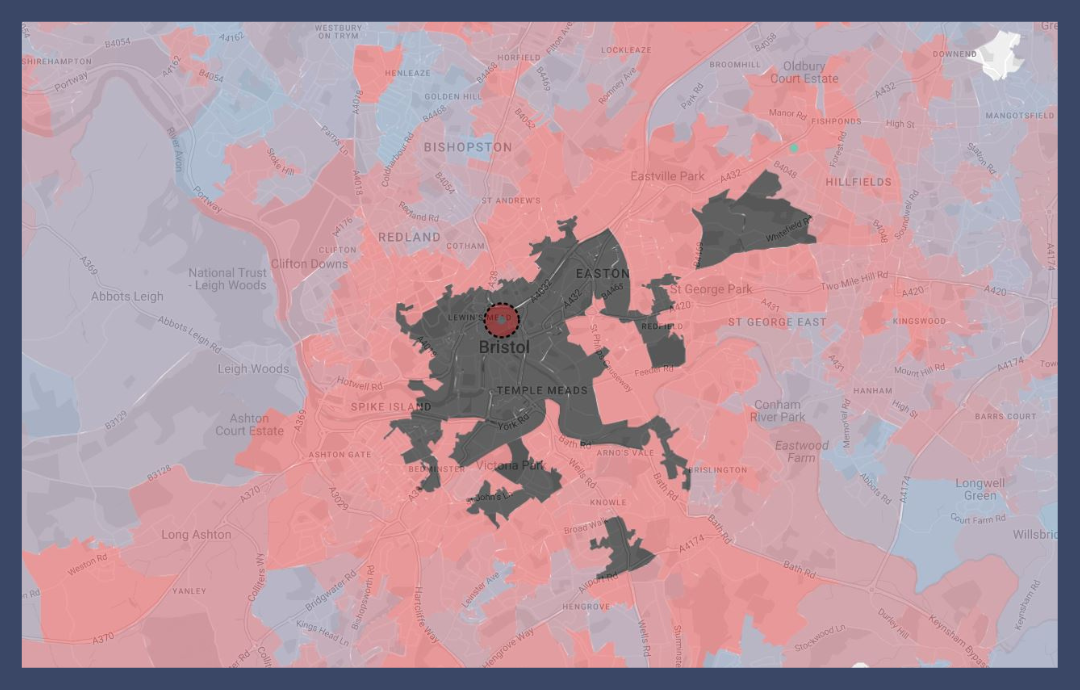
Create real catchments and not ‘guessed’ drive times
See exactly who is visiting or shopping in a particular area, and what days and times they’re likely to go. Using mobility data, simply choose a location and build catchments that are based on known consumer movement and not arbitrary guesses.
Analyse workforce and residential populations
For many businesses, such as bars, gyms or nurseries, understanding where people work is just as important as where they live. Many of your customers may not reside near your commercial premises but may work nearby or travel for business and buy from you or use your services when they’re in the area.
Therefore, understanding where workers travel from in order to get to you is equally as valuable as analysing residential consumer behaviour. However, many analysts and location analytics platforms fail to take this into account.
We’ve sought to change that. Using the mobility data now available within Periscope®, you can create catchments for working populations in addition to residential populations to allow you to understand both.
Measure Local Footfall
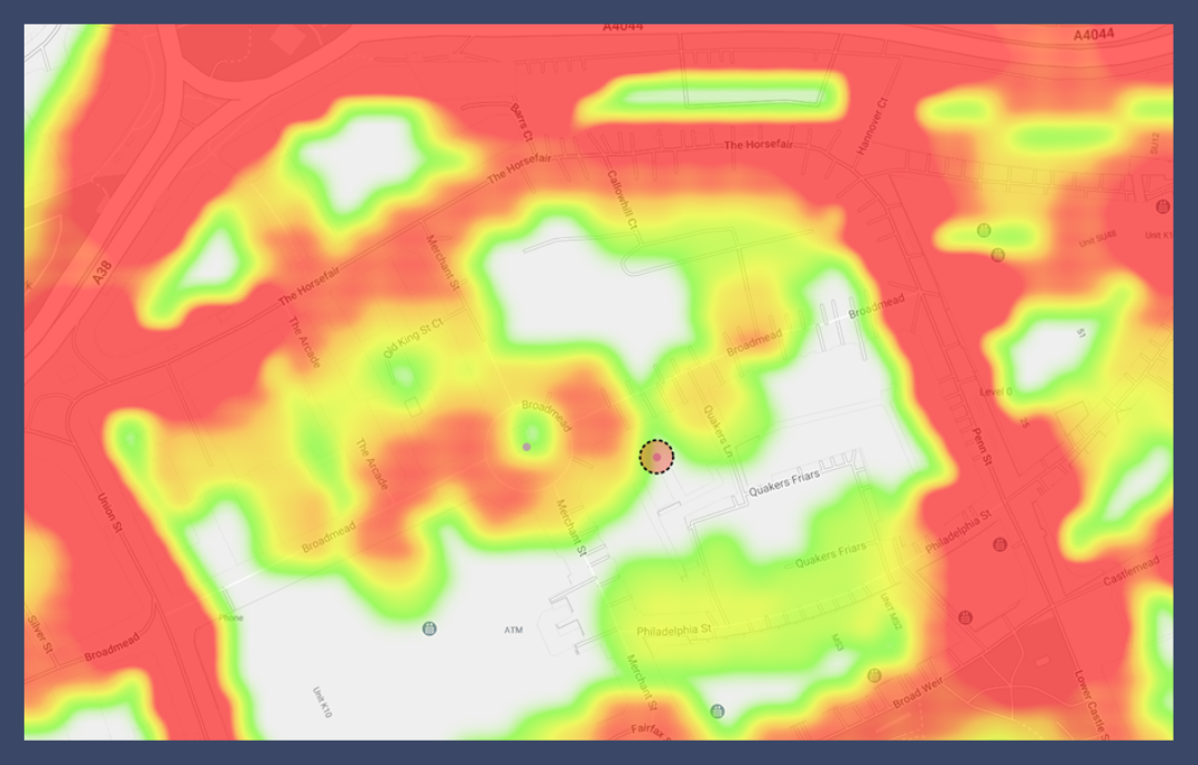
Most footfall measuring tools are reliant on capturing data at a few locations across a retail centre or a high street. They then use a model to fill in the gaps.
However, if you truly observe people’s movement in a shopping complex, you will find these models do not reflect real-life patterns on the ground. Footfall often drops off a cliff where shops end or pedestrians enter a station or car park. Pre-determined models don’t take that into account.
Using actual data to measure footfall in a shopping, city or town centre allows you to identify the prime locations in any area.
Understanding Changes over Time
Retail and leisure environments are fluid – some places are on the up, whilst other centres are struggling. Buying habits and trends have naturally only been exacerbated by the Covid-19 pandemic.
To truly appreciate the ups and downs of an area, you need to assess visitor numbers accurately over an extended period of time. Measuring tourist and shopper statistics at various times of the day over several months and years allows you to compare and contrast locations to see patterns in consumer buying behaviour and movement.
Mobility data makes this simple and easy to analyse by allowing you to chart visitor numbers in this way, so you can see how many people are passing by a potential new site or re-engage consumers at your current site(s).
See Periscope® In Action
Using data to make business decisions based on your potential customers’ real-life movements is quick and simple with Periscope®. Available 24/7 and on all devices, you can access the online mapping platform anywhere at any time.
Want to see how Periscope® can support your business and location strategies or find out more about mobility data? Book a 10-minute demo with our Sales Director, Paul Thomas, and see how the platform works.
Alternatively, you can call Paul on +44 7967 342747 or email paul.thomas@newgrove.com to arrange a personalised 1-2-1 meeting for you and/or your team.
Plus, send Paul a sample of locations before your meeting and he will show you exactly how Periscope® can support your unique business strategy and goals.


